|
Trip Planning – Oregon-California CoastPortland to Los Angeles |
|
|
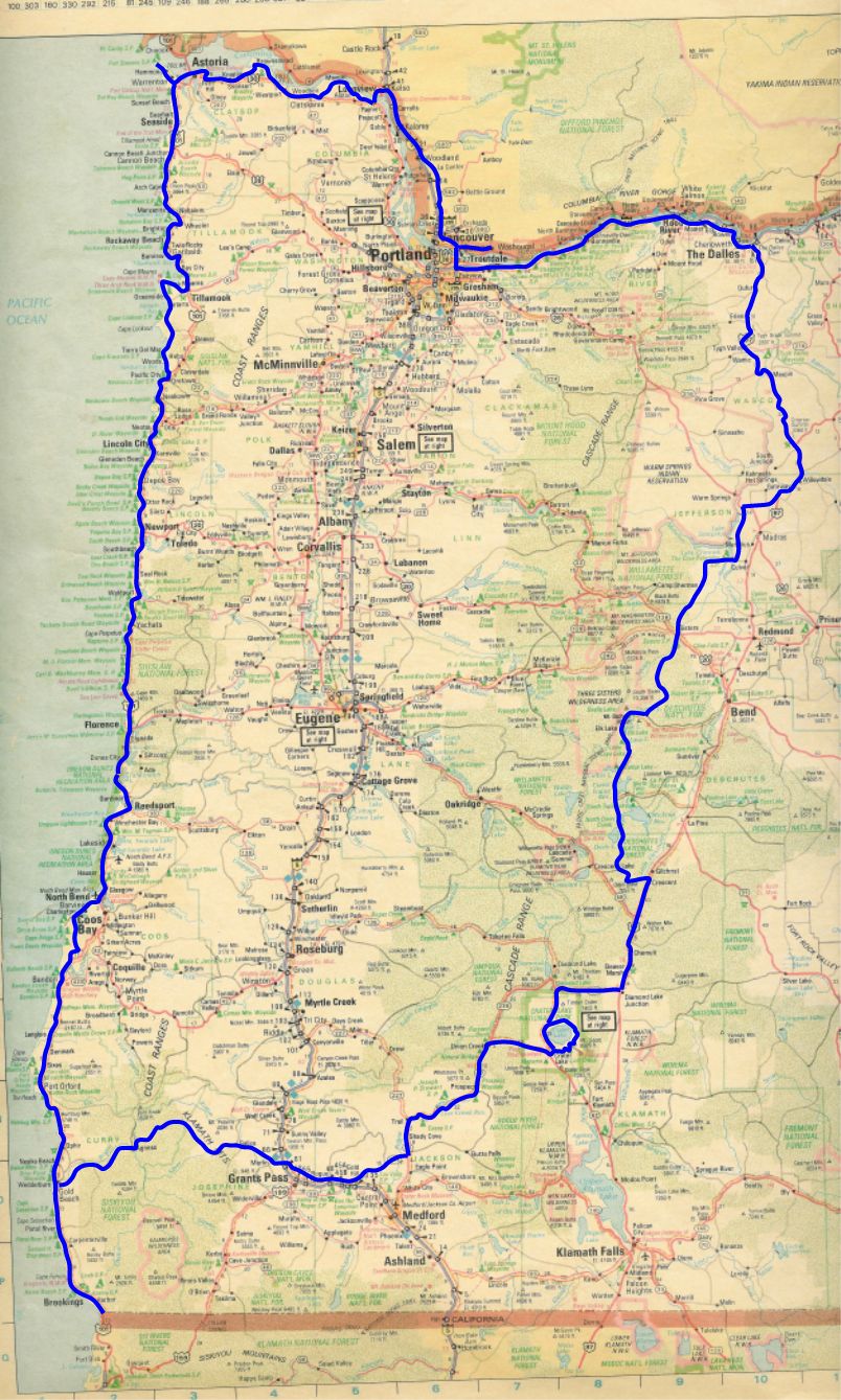
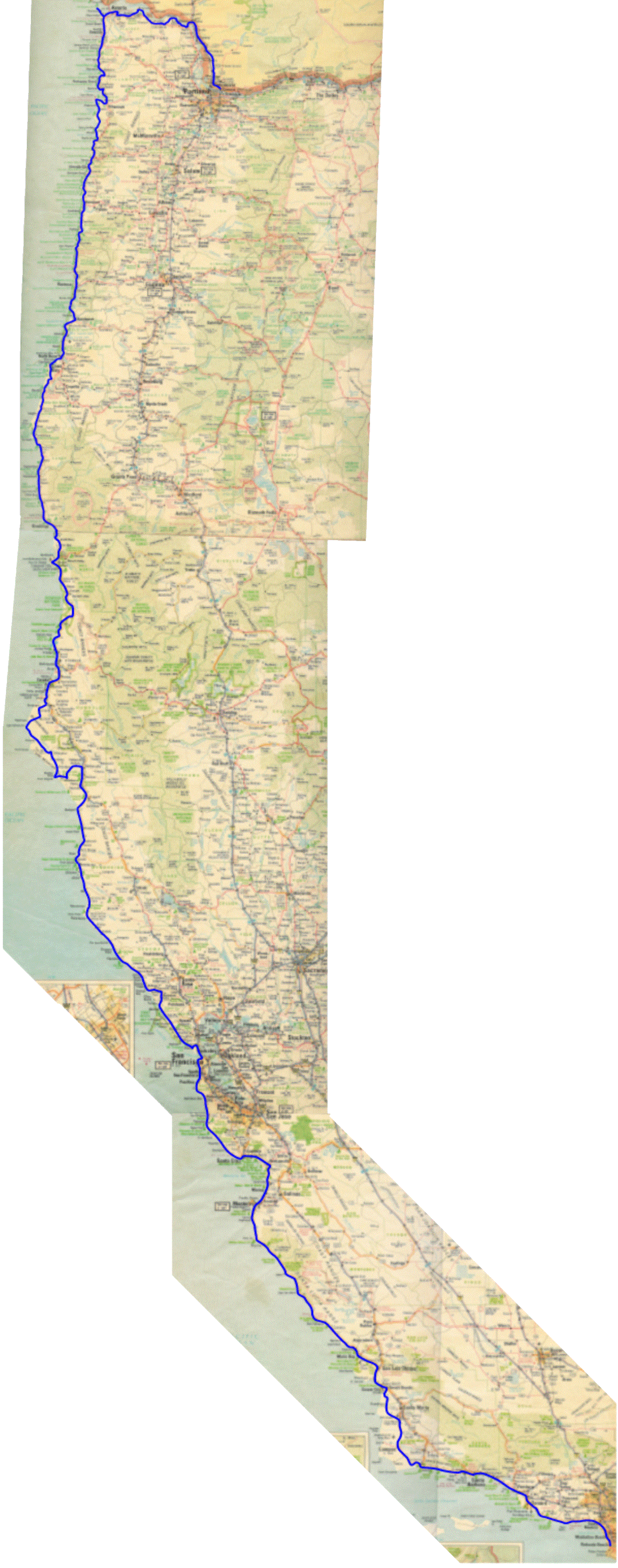
In the spring of 2005 I bought my third bicycle—a Co-Motion Americano. The goal was to start doing some serious touring again. I got it with S + S couples so that I could take it with me on business trips. In June 2005, my wife had a heart attack. That put my plans on hold. So again in 2007 I made plans, far more complete, for a some rides. It would culminate in one big end of year ride. The first plan was for a September ride. It was going to be an October ride down the Oregon coast, up to Crater Lake, down into eastern Oregon, up to the Columbia River and home. I call it the Crater Lake Loop. It is estimated at 1,120 miles. Work got in the way, my contract got extended and changed I moved to an early October ride. Checking the weather I figured I could still do it but I planned a bailout point at the California/Oregon border. When my contract got extended again, so I would not be done until the end of October. This was a little much so I changed the plans to keep the ride under the 2000 foot elevation mark to avert snow. The slightly longer ride was to LA (1MB image!). This is estimated at 1,375 miles. On October 13. 2007, my oldest son passed away and I had to postpone the trip to the spring of 2008. March is my goal. So instead of keeping this link dead, I decided that the planning process might be useful to someone just starting out. Eventually this will all be put into a set of planning pages, I am putting the more generic stuff there now. |
||
|
YouThe first thing to do is to get into shape. In my case, this was easy since I was commuting everyday to downtown Portland to the tune of twenty seven miles a day. Since I have not toured in many years I also did a test two-day ride with a fully loaded bike. My test run was the The Dalles-Portland Loop. I may need to think about this again in late winter, if I do not ride enough. |
||
|
RouteIn parallel with this, I looked for maps and laid out a route and did mileage estimates to determine how many days it would take and where I might end up in camping or road problems. The resources today are much better then in the past. Online maps, excel and Department of Transportation web sites all are resources to help out in the planning process. I have always tallied up mileage estimates, but never had it so easy as when using a spreadsheet. The attached Excel© spreadsheets show the routes for both the Crater Lake loop and the Oregon/California Coast trips. You can use these by moving the number in the "Day" column to another city's line and the number will re-calculate the formatting is based on the two numbers under "Comfortable" and "Stress" (they should be self explanatory) To make things even better I found that the California Department of Transportation had a couple of maps online to help with planning. The District 1 (Northern Coast) maps are in PDF Format or you can email the District 1 representative and he/she will mail you a hard copy. The same goes for District 5 (San Francisco to LA) maps are in PDF Format or you can email the District 5 representative and he/she will mail you a hard copy. Finally I found a set of maps for (LA itself. Why, you ask? Well what if I don't want to stop? I ned to get through LA. Maybe San Diego or Phoenix woudll be a good place to end my ride. I already had maps from the Oregon Department of Transportation. They provide a very good Oregon Coast map. So far, the only places that are troublesome are close to here, a stretch of road that lies between Woodland and Kalama, Washington, that appears to have no good way around but I5 and one stretch near Santa Monica, California, where even the DOT maps are a little sketchy. |
||
|
What To TakePlease look at the tour planning section for this. |
||
|
FoodPlease look at the food planning section for this. |
||
|
WeatherPlease look at the weather section for this. |
||
|
|
||